2023/08/19 3

QGIS: Density Analysis 플러그인 소개 (1) Styled density map(스타일링된 히트맵)

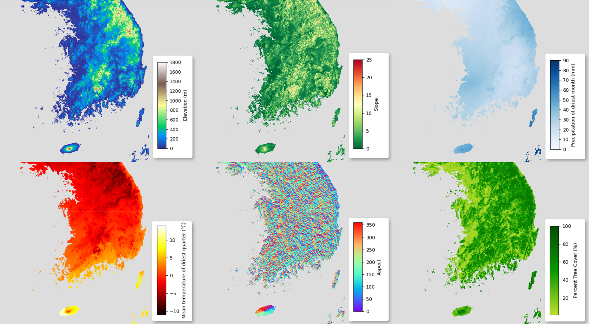
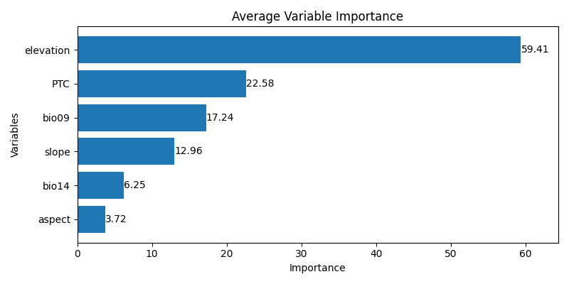
안녕하세요? 이번 글은 QGIS에서 Density Analyis 플러그인 사용법을 간략히 정리해 보겠습니다. 이 플러그인은 QGIS에 추가적인 밀도 히트맵 알고리즘을 제공하며, Geohash, H3, 스타일링된 히트맵, 그리고 폴리곤 밀도 맵을 포함합니다. Density Analysis 플러그인은 벡터 밀도 히트맵 익스플로러를 추가하여 주요 집중 지역의 핫스팟 영역을 조사할 수 있게 해줍니다. 또한 QGIS Heatmap (Kernel Density Estimation) 알고리즘을 새 버전으로 래핑하여 레이어를 자동으로 스타일링하고, 셀 크기를 레이어의 좌표계(CRS) 단위 뿐만 아니라 다양한 단위로 지정할 있도록 합니다. 폴리곤의 래스터 밀도 맵을 생성하는 알고리즘도 제공합니다. 그리고 QGIS 모델 ..

GIS 2023.08.19

pySDM-geemap: Species Distribution Modeling (SDM) using Google Earth Engine and geemap

pySDM-geemap The "pySDM-geemap" repository provides Jupyter Notebook files outlining the implementation of Species Distribution Modeling (SDM) using Google Earth Engine and geemap. The content of this repository presents a conversion and enhancement of JavaScript source code provided by researchers from the Smithsonian Conservation Biology Institute. The original JavaScript code has been transla..

REMOTE SENSING 2023.08.19

Earth Engine & Geemap: 종 분포 모델링(SDM) 구현 (6) 변수 중요도 계산

안녕하세요? 이번 글은 시리즈 글의 일부로 Google Earth Engine과 geemap을 이용한 종 분포 모델링(SDM: Species Distribution Modeling) 구현 방법을 소개해 보겠습니다. 이 글의 내용은 스미소니언 보전생물연구소 연구진 분들이 제공한 JavaScript 소스코드를 Python으로 변환하여 수정, 보완한 것입니다. Crego, R. D., Stabach, J. A., & Connette, G. (2022). Implementation of species distribution models in Google Earth Engine. Diversity and Distributions, 28, 904–916. https://doi.org/10.1111/ddi.13491..

REMOTE SENSING 2023.08.19